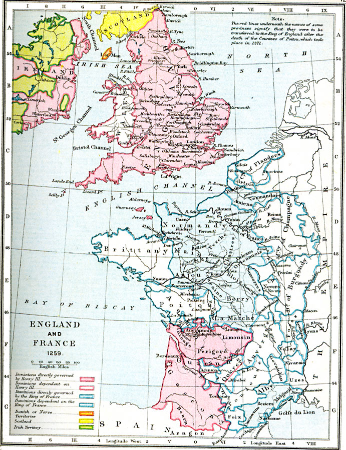
Description: A map of England and France in 1259. Map shows the dominions governed by and dependent on Henry II and the King of France. It also shows the land belonging to Scotland and the Danish or Norse, and Irish territory.
Place Names: Western Europe, Ireland, �Dublin, �Scotland, �Wales, �England, �London, �France, �Spain, �Brittany, �Normandy, �Poitou, �Champagne, �Flanders, �Burgundy, �La Marche, �Alby, �Main
ISO Topic Categories: boundaries,
inlandWaters,
location,
oceans
Keywords: England and France, physical, �political, �dominions directly governed by henry III, dominions dependent on henry iii, dominions directly governed by the king of france, dominions dependent on the king of france, danish or norse, scotland, irish territory, physical features, country borders,
major political subdivisions, boundaries,
inlandWaters,
location,
oceans, Unknown, A.D. 1259
Source: Samuel Rawson Gardiner D.C.L., L.L.D., School Atlas of English History (London, England: Longmans, Green, and Co.1, 1914) 12
Map Credit: Courtesy the private collection of Roy Winkelman |
|