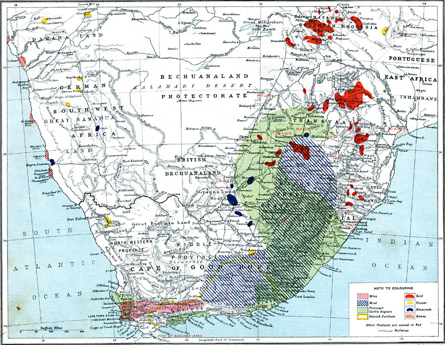
Description: A map from 1915 of southern Africa showing main economic products, principal cities, ports, railways, mountains, rivers, and coastal features throughout the region. The map is keyed to show the areas of wine, wool, cattle, and ostrich feather production, and the extraction of gold, copper, diamonds, and guano. Other principal products of the region are named in red.
Place Names: A Regional Map of Africa, Cape Town, �Durban, �East London, �Johannesburg, �Ladysmith, �Mossel Bay, �Port Elizabeth, �Pretoria, �Richards Bay, �Upingto
ISO Topic Categories: inlandWaters,
oceans,
location,
boundaries,
transportation,
farming,
economy
Keywords: Economic Map of Southern Africa, physical, �political, �borders, �boundaries, �statistical, �agriculture, �industry, �economic, �transportation, �routes, �railroads, physical features, country borders, industry,
economic,
agriculture, water routes,
railroads, inlandWaters,
oceans,
location,
boundaries,
transportation,
farming,
economy, Unknown, 1915
Source: J.G. Bartholomew, A School Economic Atlas (London, England: Oxford University Press, 1915) 39
Map Credit: Courtesy the private collection of Roy Winkelman |
|