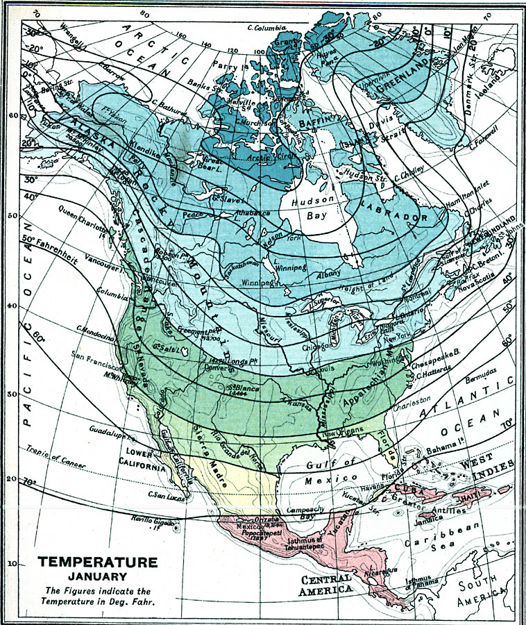
Description: A map from 1915 of North America showing average temperatures for the month of January, given in degrees Fahrenheit.
Place Names: A Complete Map of North America, Boston, �Chicago, �Houston, �Los Angeles, �Miami, �New Orleans, �New York, �San Diego, �Seattle, �Washington D.C., �temperatur
ISO Topic Categories: inlandWaters,
oceans,
location,
boundaries,
climatologyMeteorologyAtmosphere
Keywords: A Complete Map of North America, physical, �political, �borders, �boundaries,�meteorological, �climate, �temperature, kClimate,physical features, country borders, climate,
temperature, inlandWaters,
oceans,
location,
boundaries,
climatologyMeteorologyAtmosphere, Unknown, 1915
Source: J. G. Bartholomew, A School Economic Atlas (London, England: Oxford University Press, 1915) 40
Map Credit: Courtesy the private collection of Roy Winkelman |
|