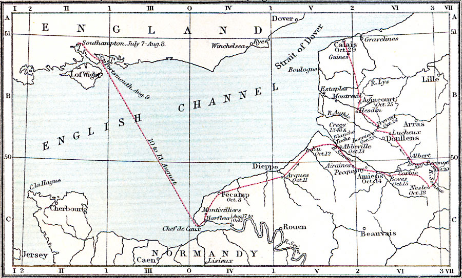
Description: A map of Henry V's first campaign in France in the year 1415. The map shows his path from departure in Southampton to Portsmouth (August 9), across the English Channel to Chef de Caux, and his overland route and eventual arrival in Calais (October 29, 1415).
Place Names: Western Europe, England, �France, �English Channel, �Strait of Dover, �Dover, �Southampton, �Isle of Wight, �Cherbourg, �Normandy, �Montivilliers, �Fecamp, �Argues, �Eu, �Abbeville, �Amiens, �Calai
ISO Topic Categories: inlandWaters,
location,
oceans
Keywords: Henry V's First Campaign in France, physical, �political, �historical, �map of henry v's first campaign in france a.d. 1415, henry 5 1415 CE, henry the fifth, physical features, country borders,
major political subdivisions, historical event,
other military, inlandWaters,
location,
oceans, Unknown, 1415
Source: Samuel Rawson Gardiner D.C.L., L.L.D., School Atlas of English History (London, England: Longmans, Green, and Co.1, 1914) 16
Map Credit: Courtesy the private collection of Roy Winkelman |
|