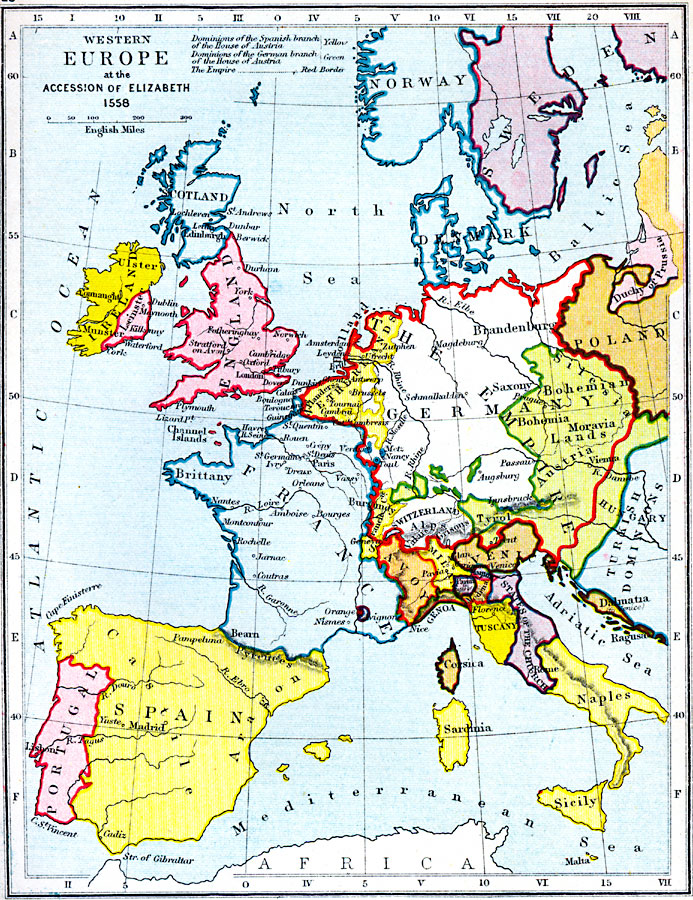
Description: A map of Western Europe in the time of the Accession of Elizabeth (1558), showing boundaries and principal cities. The map is color–coded to show the dominions of the Spanish branch of the House of Austria in yellow and the German branch in green. The boundaries of the Holy Roman Empire at the time are given in red.
Place Names: Western and Central Europe, Scotland, �Ireland, �Leinster, �England, �Portugal, �Spain, �France, �Germany, �Netherlands, �Naples, �Sicily, �Sardinia, �Corsica, �Tuscany, �Savoy, �Venice, �Poland, �Denmark, �Norway, �Sweden, �Switzerlan
ISO Topic Categories: inlandWaters,
location,
oceans,
boundaries
Keywords: Western Europe at the Accession of Elizabeth, physical, �political, �historical, �western europe at the time of the accession of elizabeth in 1558, dominions of the spanish branch of the house of austria, dominions of the german branch of the house of austria, physical features, country borders, historical event, inlandWaters,
location,
oceans,
boundaries, Unknown, 1558
Source: Samuel Rawson Gardiner D.C.L., L.L.D., School Atlas of English History (London, England: Longmans, Green, and Co.1, 1914) 23
Map Credit: Courtesy the private collection of Roy Winkelman |
|