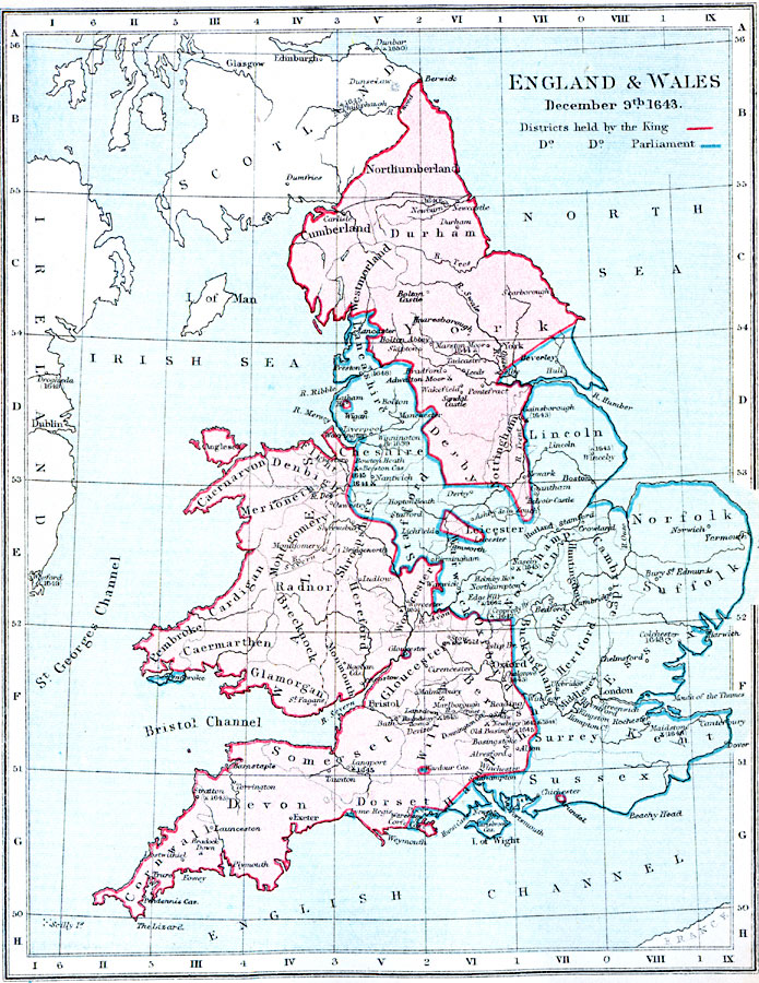
Description: A map of England and Wales as they were on December 9th, 1643, during the First English Civil War (1642–1646). The map is color–coded to show the districts held by the King and districts controlled by Parliament in the ongoing English Civil War. The date corresponds to the death of John Pym (December 8, 1643), the English parliamentarian and leader of the Long Parliament. The map shows major battle sites of the war with dates given.
Place Names: United Kingdom, Northumberland, �Cumberland, �London, �Bristol, �Exeter, �Greenwich, �Norwich, �York, �Leicester, �Glasgow, �Edinborough, �Edinburgh, �Manchester, �Dove
ISO Topic Categories: inlandWaters,
location,
oceans,
boundaries
Keywords: England and Wales, physical, �political, �england and wales, districts held by the king, districts held by parliament, english civil war, �historical, physical features, major political subdivisions,
country borders, other military, inlandWaters,
location,
oceans,
boundaries, Unknown, December 9, 1643
Source: Samuel Rawson Gardiner D.C.L., L.L.D., School Atlas of English History (London, England: Longmans, Green, and Co.1, 1914) 30
Map Credit: Courtesy the private collection of Roy Winkelman |
|