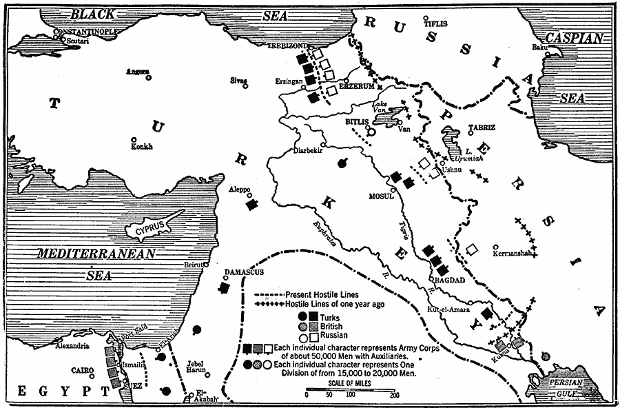
Description: A map of Asia Minor during the Caucasus Campaign of 1915–1916 during WWI between the Ottoman Turks and the opposing forces of British and Russians. The map shows the battle lines from 1915 and 1916, the military positions of the Turks, British, and Russian army corps and divisions, and the approximate strength of each.
Place Names: Southwest Asia, Black Sea, �Caspian Sea, �Cypress, �Egypt, �Mediterranean Sea, �Russia, �Turkey,
ISO Topic Categories: location,
inlandWaters,
oceans,
boundaries
Keywords: Campaign in Asia Minor, borders, �historical, �physical, �World War I, country borders, WWI, location,
inlandWaters,
oceans,
boundaries, Unknown, 1915–1916
Source: Willis J. Abbot, Pictorial History of the World War (New York, NY: Leslie-Judge Company, 1919) 115
Map Credit: Courtesy the private collection of Roy Winkelman |
|