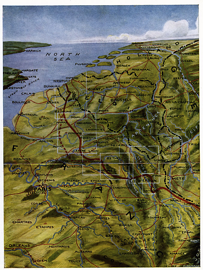
Description: A bird's–eye view of the whole western front in 1916. It shows plainly the two gates from Germany into France, and highlights specific areas of intense fighting.
Place Names: Western Europe, Belgium, �France, �Germany, �Holland, �North Se
ISO Topic Categories: location,
inlandWaters,
oceans,
boundaries
Keywords: A Bird's Eye View of the Western Front, borders, �historical, �physical, �World War I, kWWI, country borders, WWI, location,
inlandWaters,
oceans,
boundaries, Unknown, World War I
Source: Willis J. Abbot, Pictorial History of the World War (New York, NY: Leslie-Judge Company, 1919) 155
Map Credit: Courtesy the private collection of Roy Winkelman |
|