mapsMaps ETC Site map
 Maps ETC > United States > Southern States > Alluvial Valley and Delta of the Mississippi River , 1901
Site Map 

Alluvial Valley and Delta of the Mississippi River , 1901

Alluvial Valley and Delta of the Mississippi River


Title: Alluvial Valley and Delta of the Mississippi River
Projection: Unknown,
Source Bounding Coordinates:
W: -92 E: -89 N: 37 S: 29

Main Map Page
Zoomify Version
B/W PDF Version
Color PDF Version
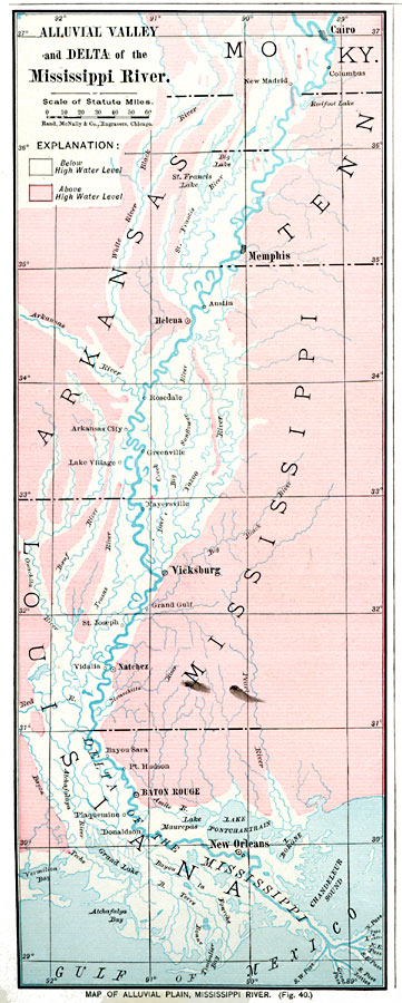
Description: Alluvial Plain, Mississippi River.
Place Names: Southern States, Arkansas, Kentucky, Louisiana, Mississippi, Missouri, Tennessee,
ISO Topic Categories: oceans, location, inlandWaters
Keywords: Alluvial Valley and Delta of the Mississippi River , borders, hydrological, physical, water depths, physical features, water depths, oceans, location, inlandWaters, Unknown, 1901
Source: James A. Bowen, Grammar School Geography (Chicago, IL: Rand, McNally & Company, 1901) 22
Map Credit: Courtesy the private collection of Roy Winkelman
SearchLicensePDF HelpGIS Help Google Earth Help Zoomify Help

 Maps ETC > United States > Southern States > Alluvial Valley and Delta of the Mississippi River , 1901
Site Map