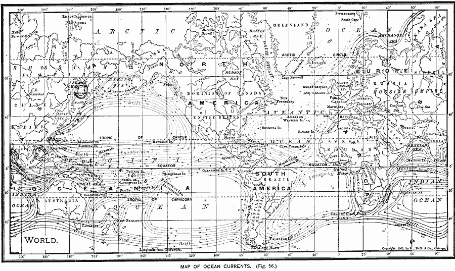
Description: A chart from 1901 showing the principal ocean currents and ocean drifts of the world. The map shows both warm and cold currents and direction of flow for the Gulf Stream, Labrador, Greenland, Japan, California, and South Equatorial currents, the West Wind, Monsoon, North Equatorial and South Equatorial drifts.
Place Names: A Complete Map of Globes and Multi-continent, Africa, �Antarctica, �Asia, �Australia, �Europe, �North America, �South Americ
ISO Topic Categories: oceans,
location,
inlandWaters,
climatologyMeteorologyAtmosphere
Keywords: Map of Ocean Currents, borders, �hydrological, �physical, �water depths, kOceanCurrents, water depths, oceans,
location,
inlandWaters,
climatologyMeteorologyAtmosphere, Unknown, 1901
Source: James A. Bowen, Grammar School Geography (Chicago, IL: Rand, McNally & Company, 1901) 30
Map Credit: Courtesy the private collection of Roy Winkelman |
|