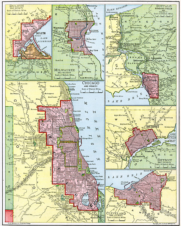
Description: A series of maps from 1901 of the principal U.S. port cities of the Great Lakes, including details of Duluth, Milwaukee, Buffalo, Chicago, Detroit, and Cleveland. The details show the city limits at the time, major roads, railroads, and canals, harbors and breakwaters, and city features such as parks, railway stations, and neighboring cities.
Place Names: Midwest States, Buffalo, �Chicago, �Cleveland, �Detroit, �Duluth, �Milwauke
ISO Topic Categories: oceans,
location,
inlandWaters
Keywords: Great Lake Ports, borders, �physical, �transportation, �water routes, �physical features, country borders, water routes, rainfall, oceans,
location,
inlandWaters, Unknown, 1901
Source: James A. Bowen, Grammar School Geography (Chicago, IL: Rand, McNally & Company, 1901) 87
Map Credit: Courtesy the private collection of Roy Winkelman |
|