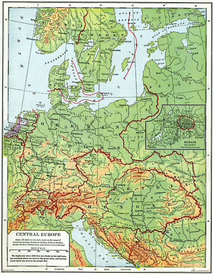
Description: A map from 1901 of Central Europe, showing borders at the time, major cities, rivers, and coastal features. The map is color–coded to show general land elevations over 2000 feet above sea level in buff tints, lowlands in green, and the lowlands below sea level in purple. The countries include Denmark, Netherlands, Germany, Luxemburg, Switzerland, Austria–Hungary, and the frontiers of Norway, Sweden, Belgium, France, Italy, Russia, Poland, Roumania, Servia, and Bulgaria. An inset map details the city of Berlin and vicinity.
Place Names: Western and Central Europe, Stavanger, �Bergen, �Drammen, �Gefle, �Aarhuus, �Amsterdam, �Liege, �Bern, �Zurich, �Stuttgart, �Strassburg, �Munich, �Nuremberg, �Frankfurt, �Chemnitz, �Brunn, �Debreczin, �Berli
ISO Topic Categories: boundaries,
inlandWaters,
location,
oceans,
transportation
Keywords: Central Europe and Berlin, physical, �political, �transportation, physical features, country borders, roads, boundaries,
inlandWaters,
location,
oceans,
transportation, Unknown, 1901
Source: Jacques W. Redway, Natural Advanced Geography (New York, NY: American Book Company, 1901) 127
Map Credit: Courtesy the private collection of Roy Winkelman |
|