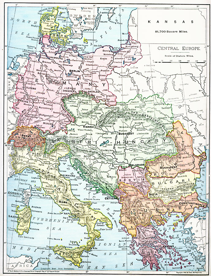
Description: A map from 1901 of Central Europe showing the boundaries of Denmark, Germany, Switzerland, Austria–Hungary, Roumania, Servia, Bulgaria, Turkey in Europe, Greece, Italy, and the islands of Corsica, Sardinia, and Sicily at the time, and includes the frontiers of Sweden, Russia, the Netherlands, Belgium, and France. The map shows capitals and major cities, mountains and terrain, lakes, rivers, coastal features, and islands. An outline map of Kansas is included at the same map scale to show the comparative area size relationship.
Place Names: Western and Central Europe, Austria, �Denmark, �Germany, �Greece, �Hungary, �Italy, �Romania, �Serbia, �Switzerland, �Turke
ISO Topic Categories: oceans,
location,
inlandWaters
Keywords: Central Europe, borders, �physical, kComparativeArea, country borders, oceans,
location,
inlandWaters, Unknown, 1901
Source: James A. Bowen, Grammar School Geography (Chicago, IL: Rand, McNally & Company, 1901) 169
Map Credit: Courtesy the private collection of Roy Winkelman |
|