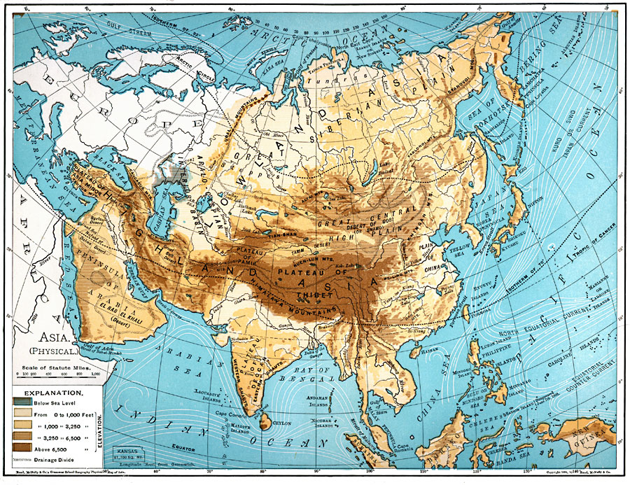
Description: A map of Asia from 1901 showing the physical features of the region including mountain systems, plateaus, basins, plains, deserts, lakes, rivers, and coastal features and islands. The map shows major ocean currents, the mean annual isotherms of 32° and 70° Fahrenheit, the drainage divides of the major watersheds, and uses color–contouring to show land elevations from below sea level north of the Caspian Sea to above 6,500 feet. An outline map of Kansas at the same map scale is included to show comparative area size.
Place Names: A Complete Map of Asia, highland, �lowland, �Siberi
ISO Topic Categories: oceans,
location,
inlandWaters,
elevation
Keywords: Asia (Physical), borders, �physical, �topographical, kComparativeArea, topographical, country borders, oceans,
location,
inlandWaters,
elevation, Unknown, 1901
Source: James A. Bowen, Grammar School Geography (Chicago, IL: Rand, McNally & Company, 1901) 176
Map Credit: Courtesy the private collection of Roy Winkelman |
|