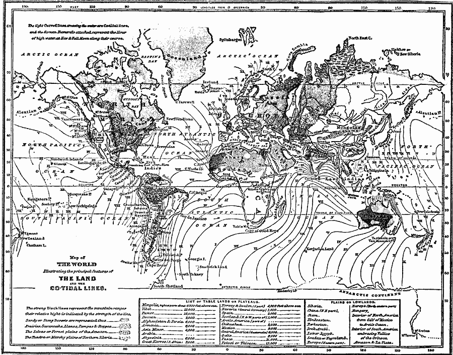
Description: A map from 1855 of the world, showing the principal land features and co–tidal lines. The strong black lines on the map represent the mountain ranges, their relative height is indicated by the strength of the line. The map is keyed to show sandy or stony deserts, the areas of prairies, savannahs, llanos, pampas, and steppes, the region of selvas or forested plains of the Amazon, and the region of tundra or marshy plains of northern Siberia. The light curved lines crossing the water are co–tidal lines marking the areas where high–tide is peaked at different locations at the same time, showing the progression of the high water at new and full moon. The Roman Numerals represent the hour of high water along their course. A table at the bottom of the map lists principal plateau areas, with their elevations given in feet above sea level.
Place Names: A Complete Map of Globes and Multi-continent, Africa, �Antarctica, �Asia, �Australia, �Europe, �North America, �South Americ
ISO Topic Categories: oceans,
inlandWaters,
location,
elevation
Keywords: Map of the World illustrating the principal features of the land and the co-tidal lines, borders, �physical, �topographical, topographical, oceans,
inlandWaters,
location,
elevation, Unknown, 1855
Source: George W. Fitch, Outlines of Physical Geography (New York, NY: Ivison, Phinney, Blakeman & Company, 1868) 4
Map Credit: Courtesy the private collection of Roy Winkelman |
|