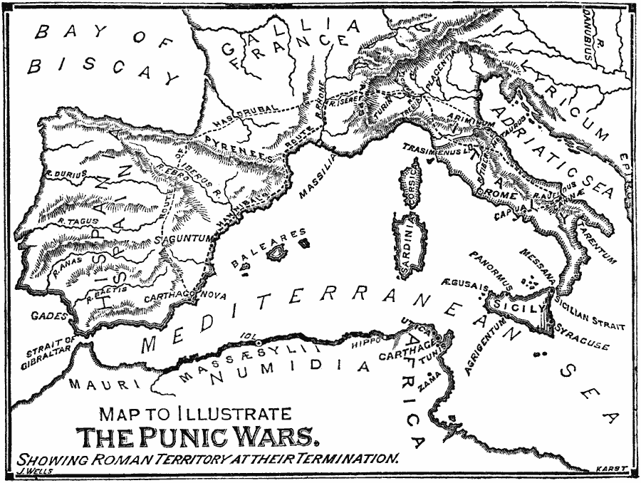
Description: A map of the western portion of the Mediterranean, including Italy, southern France, Spain, and northern Africa from the Strait of Gibraltar to Carthage. The map illustrates the area of the Punic Wars (264–146) between Rome and Carthage, and shows the extent of the Roman Empire at the end of the wars. The map shows the major cities of the time, rivers, and mountain systems, and the routes of the Carthaginians Hannibal and Hasdrubal to Roman Italy during the Second Punic War.
Place Names: Regional Mediterranean, Africa, �Europ
ISO Topic Categories: physical, �political, �transportation, kWorldMedSea, kWorldEuroAfrica
Keywords: The Punic Wars, physical, �political, �transportation, physical features, local jurisdictions, physical, �political, �transportation, kWorldMedSea, kWorldEuroAfrica, 264–146 B.C.
Source: William Swinton, Outlines of the World's History (New York, NY: Ivison, Blakeman, and Company, 1874) 148
Map Credit: Courtesy the private collection of Roy Winkelman |
|