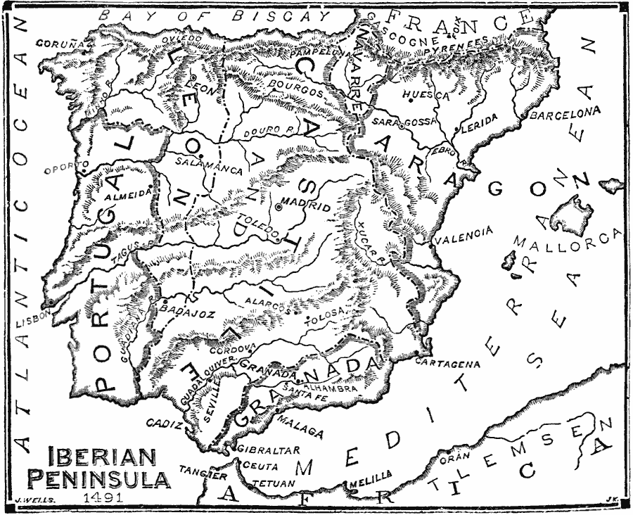
Description: A map of the Iberian Peninsula in 1491, just prior to the surrender of Granada by Muhammad XII to Ferdinand and Isabella, king and queen of Castile and Aragon (January 2, 1492). The map shows Portugal, the frontier with Gascogne, France, the Nasrid Kingdom of Granada, and the kingdoms of Leon, Castile, Navarre, and Aragon, including the Balearic Islands. The map shows major cities of the time, mountain systems and terrain, rivers, and coastal features.
Place Names: Iberian Peninsula, Portugal, �Spain, �Aragon, �Leon, �Granada, �Cadiz, �Madrid, �Lisbo
ISO Topic Categories: boundaries,
location,
oceans,
inlandWaters
Keywords: The Iberian Peninsula, physical, �political, physical features, country borders,
major political subdivisions, boundaries,
location,
oceans,
inlandWaters, 1491
Source: William Swinton, Outlines of the World's History (New York, NY: Ivison, Blakeman, and Company, 1874) 298
Map Credit: Courtesy the private collection of Roy Winkelman |
|