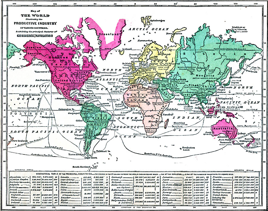
Description: A map from 1868 of the world, showing the primary productive industries of various countries, and the principal ship routes between major ports. The map shows the mineral fishery, fur, and agricultural resources in Asia, Europe, Africa, North and South America, Australasia, and Oceania. The statistical table at the bottom of the map lists principal countries, with area given in English square miles, the total population at the time, and the number of inhabitants per square mile.
Place Names: A Complete Map of Globes and Multi-continent, Africa, �Antarctica, �Asia, �Australia, �Europe, �North America, �South Americ
ISO Topic Categories: oceans,
inlandWaters,
location,
economy
Keywords: Map of the World Illustrating Industry, Commerce, and Navigation, borders, �economic, �industry, �statistical, �transportation, �water routes, kEconomic, population,
industry,
economic, oceans,
inlandWaters,
location,
economy, Unknown, 1868
Source: George W. Fitch, Outlines of Physical Geography (New York, NY: Ivison, Phinney, Blakeman & Company, 1868) 102
Map Credit: Courtesy the private collection of Roy Winkelman |
|