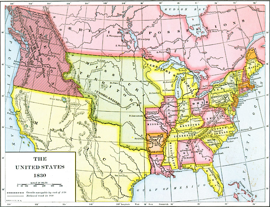
Description: A map of the United States in 1830 showing the states and territories, the joint–occupation with Britain in Oregon Country, and the British and Spanish possessions at the time. The map shows the westward expansion of the United States, with the frontier line (heavy dashed line) at the time extending from just north of Detroit westward to Fort Leavenworth in the unorganized Missouri Territory, south along the Mississippi River, into the Arkansas Territory, and south to the Gulf near the boundary with Mexico as established by the Treaty of 1819. The map shows the navigable canal system in the east, and the extent of the National Road in 1830 from Cumberland to Zanesville Ohio.
Place Names: A Complete Map of the United States, Alabama, �Arkansas Territory, �Connecticut, �Delaware, �Florida Territory, �Georgia, �Indiana, �Kentucky, �Maine, �Maryland, �Massachusetts, �Michigan Territory, �Mississippi, �Missouri, �New Jersey, �New York, �North Carolina, �Ohio, �Oregon, �Pennsy
ISO Topic Categories: oceans,
location,
inlandWaters,
transportation
Keywords: The United States, borders, �canals, �political, �roads, �transportation, �water routes, country borders, roads,
water routes, oceans,
location,
inlandWaters,
transportation, Unknown, 1830
Source: Dixon Ryan Fox, Harper's Atlas of American History (New York, NY: Harper & Brothers Publishers , 1920) 38
Map Credit: Courtesy the private collection of Roy Winkelman |
|