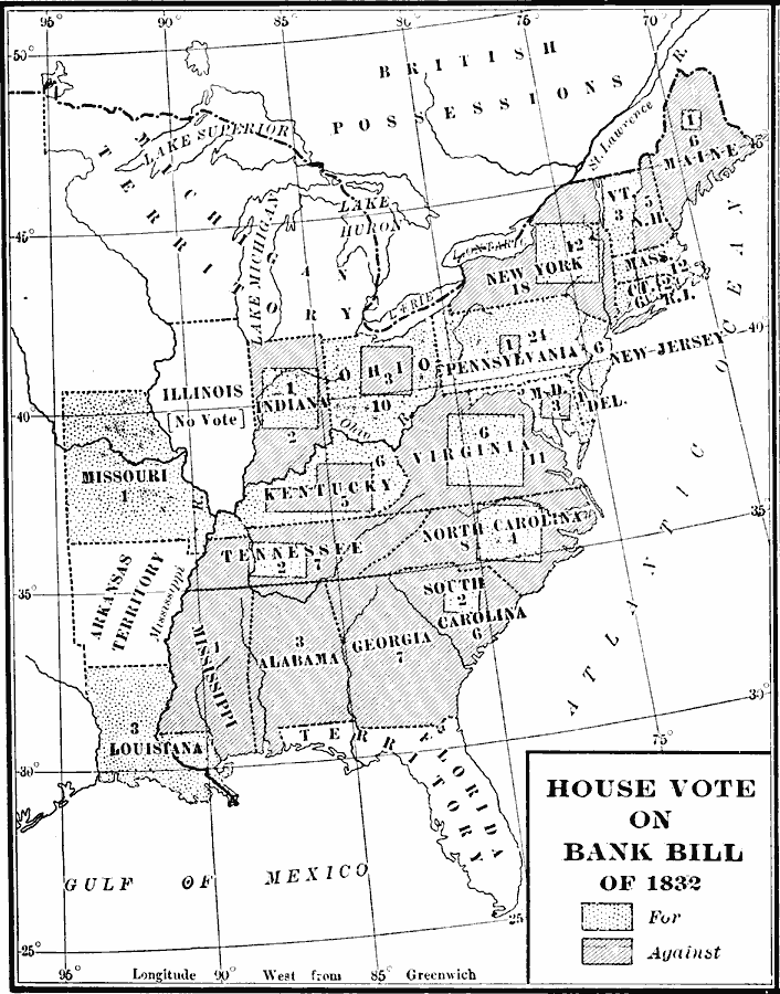
Description: A map of the United States showing the results of the House vote on the Bank Bill of 1832 during the presidency of Andrew Jackson. The bill was a re–chartering of the Second Bank of the United States, an institution vehemently opposed by Jackson, who vetoed the bill.
Place Names: Elections, Alabama, �Arkansas Territory, �Connecticut, �Delaware, �Florida Territory, �Georgia, �Illinois, �Indiana, �Kentucky, �Louisiana, �Maryland, �Michigan Territory, �Mississippi, �Missouri, �New Hampshire, �New Jersey, �New York, �North Carolina, �Ohio, �
ISO Topic Categories: oceans,
location,
inlandWaters
Keywords: House Vote on the Bank Bill, historical, historical event, oceans,
location,
inlandWaters, Unknown, 1832
Source: Dixon Ryan Fox, Harper's Atlas of American History (New York, NY: Harper & Brothers Publishers , 1920) 39
Map Credit: Courtesy the private collection of Roy Winkelman |
|