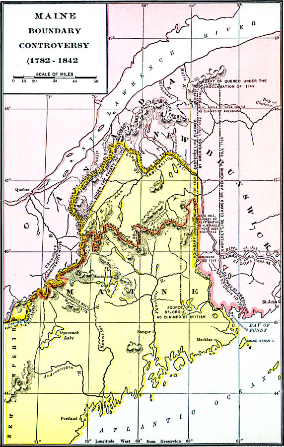
Description: A map of Maine showing the boundary disputes with Quebec and New Brunswick between 1763–1842. The map shows the areas claimed by Quebec under the Proclamation of 1763, by the Americans to St. Croix River till 1798, by Great Britain from 1821 to 1842, and the boundaries established under the Treaty of 1842.
Place Names: Maine, Bangor, �Maine, �New Brunswick, �Portlan
ISO Topic Categories: oceans,
location,
inlandWaters,
boundaries
Keywords: Maine Boundary Controversy, borders, �historical, �political, country borders, historical event, oceans,
location,
inlandWaters,
boundaries, Unknown, 1763–1842
Source: Dixon Ryan Fox, Harper's Atlas of American History (New York, NY: Harper & Brothers Publishers , 1920) 43
Map Credit: Courtesy the private collection of Roy Winkelman |
|