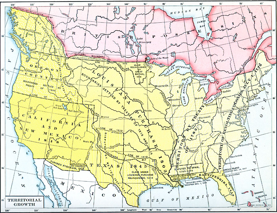
Description: A map from 1890 of the United States showing the territorial expansion from the original Thirteen Colonies in 1776 to the territories prior to the Kansas–Nebraska Act of 1856. The map shows the territories, territorial disputes, and boundary disputes of westward expansion from the newly formed states in 1783 to the Gadsden Purchase in northern Mexico in 1853, including the territories gained by the Treaty of 1783, the Louisiana Purchase in 1803, the Texas Territory and Oregon Country in 1846, and the California and New Mexico Territory in 1848.
Place Names: Growth of Nation, California, �Florida, �Louisiana Purchase, �New Mexico, �Oregon, �Texa
ISO Topic Categories: oceans,
location,
inlandWaters
Keywords: Territorial Growth , historical, �historical event, oceans,
location,
inlandWaters, Unknown, 1776–1854
Source: Dixon Ryan Fox, Harper's Atlas of American History (New York, NY: Harper & Brothers Publishers , 1920) 46
Map Credit: Courtesy the private collection of Roy Winkelman |
|