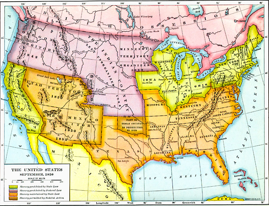
Description: A map of the United States at the time of the passing of the Compromise of 1850 (September, 1850). This compromise was a series of bills attempting to resolve territorial and slavery issues raised by the Missouri Compromise (1820) and the Mexican–American War (1846–1848) by balancing the interests of the slave states and free states. The map is color–coded to show areas where slavery was prohibited by State Law, areas where slavery was prohibited by Federal Law, areas where slavery was maintained by State Law, and areas where slavery was permitted by Federal Action.
Place Names: A Complete Map of the United States, Alabama, �Arkansas Territory, �Connecticut, �Delaware, �Florida Territory, �Georgia, �Indian Country, �Indiana, �Kentucky, �Maine, �Maryland, �Massachusetts, �Michigan Territory, �Mississippi, �Missouri, �New Jersey, �New York, �North Carolina, �Ohio,
ISO Topic Categories: oceans,
location,
inlandWaters
Keywords: The United States, historical, �slavery, country borders, roads,
water routes, historical event, oceans,
location,
inlandWaters, Unknown, September, 1850
Source: Dixon Ryan Fox, Harper's Atlas of American History (New York, NY: Harper & Brothers Publishers , 1920) 48
Map Credit: Courtesy the private collection of Roy Winkelman |
|