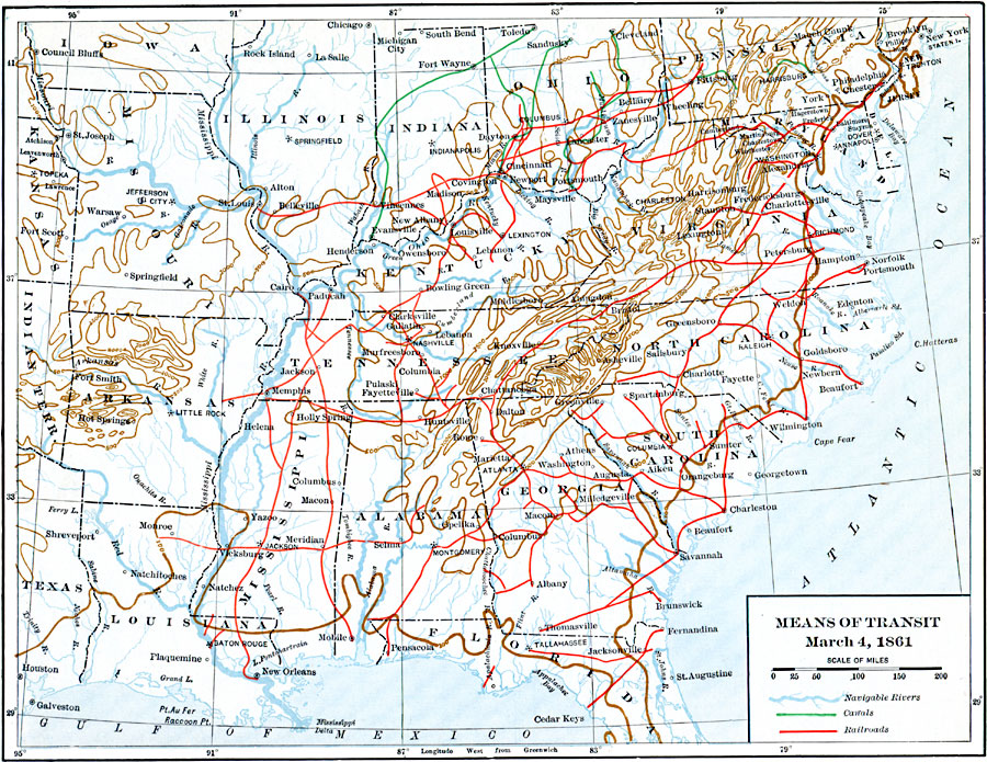
Description: Means of transit, circa March 4, 1861.
Place Names: Eastern States, Alabama, �Arkansas, �Connecticut, �Delaware, �Florida, �Georgia, �Illinois, �Indiana, �Iowa, �Kentucky, �Maine, �Maryland, �Massachusetts, �Michigan, �Mississippi, �Missouri, �New Jersey, �New York, �North Carolina, �Ohio, �Pennsylvania, �Rhode Isla
ISO Topic Categories: oceans,
location,
inlandWaters,
transportation
Keywords: Means of Transit, railroads,�transportation, �water routes, railroads,
water routes, oceans,
location,
inlandWaters,
transportation, Unknown, March 4, 1861
Source: Dixon Ryan Fox, Harper's Atlas of American History (New York, NY: Harper & Brothers Publishers , 1920) 60
Map Credit: Courtesy the private collection of Roy Winkelman |
|