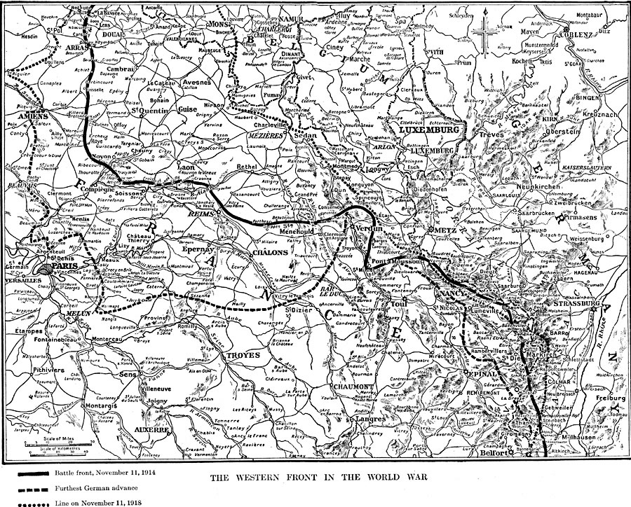
Description: A map of portions of France, Germany, Belgium, and Luxemburg between 1914 and 1918, showing the Western Front of World War I. The map shows the battle front on November 11, 1914, the furthest advance of the Germans during the war, and the battle line on November 11, 1918. Major cities, roads, terrain, and rivers of the region are shown.
Place Names: Western Europe, Belgium, �France, �Germany, �Paris, �Reims, �Verdu
ISO Topic Categories: oceans,
location,
inlandWaters
Keywords: The Western Front in the World War, historical, �political, �subdivisions, �war, kWWI, major political subdivisions, historical event,
WWI, oceans,
location,
inlandWaters, Unknown, 1914–1918
Source: Dixon Ryan Fox, Harper's Atlas of American History (New York, NY: Harper & Brothers Publishers , 1920) 83
Map Credit: Courtesy the private collection of Roy Winkelman |
|