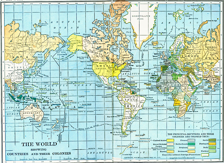
Description: A map from 1921 of the world showing colonial possessions and former possessions after World War I. The map is color–coded to show the possessions at the time of the United States, Great Britain, the former German colonies under Allied control, Russia, Netherlands, Belgium, Denmark, Spain, Portugal, Italy, and Turkey. Countries without foreign possession are shown outlined in yellow. The map shows capitals and major cities, political boundaries at the time, rivers, and the extreme limits of icebergs.
Place Names: A Complete Map of Globes and Multi-continent, Africa, �Antarctica, �Asia, �Australia, �Europe, �North America, �South Americ
ISO Topic Categories: oceans,
location,
inlandWaters
Keywords: The World Post WWI, borders, �physical, � country borders, historical event, oceans,
location,
inlandWaters, Unknown, 1921
Source: L.L. Poates, Poates Complete Atlas of the World (New York, NY: Poates Corporation , 1921) 4-5
Map Credit: Courtesy the private collection of Roy Winkelman |
|