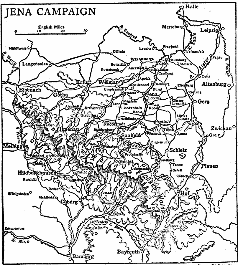
Description: A map of the area around Jena, Germany, showing the battle site where French forces under Napoleon defeated Prussian forces under Fredrick William III on 14 October, 1806 during the War of the Fourth Coalition. The map shows neighboring cities, roads, rivers, and terrain features in the area.
Place Names: Germany, Weimar, �Saalfeld, �Schlei
ISO Topic Categories: location,
inlandWaters,
transportation,
intelligenceMilitary
Keywords: The Jena Campaign, physical, �transportation, �political, kNapoleonicWars, physical features, country borders, roads, location,
inlandWaters,
transportation,
intelligenceMilitary, Unknown, 1806
Source: The Encyclopedia Britannica, The Encyclopedia Britannica Vol 19 (New York, NY: The Encyclopedia Britannica Company, 1911) 220
Map Credit: Courtesy the private collection of Roy Winkelman |
|