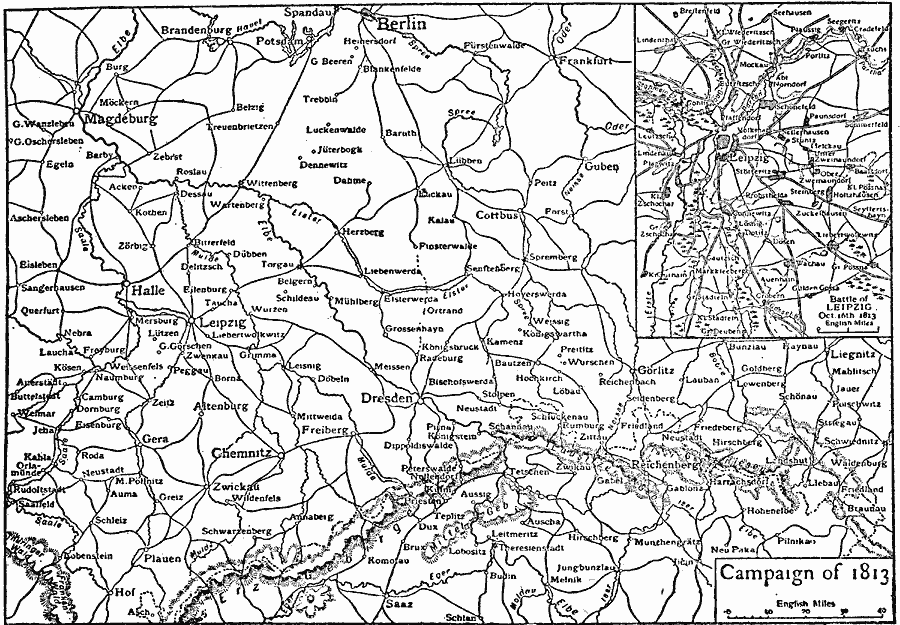
Description: A map of the area around Leipzig, Germany, showing the battle site where French forces under Napoleon were defeated by the forces of the Sixth Coalition (Russia, Austria, Prussia, Sweden, Britain, Spain, Portugal, and the German Confederation of the Rhine) at the Battle of Leipzig or Battle of the Nations, 16–19 October, 1813. The defeat resulted in the exile of Napoleon to Elbe. The map shows neighboring cities, roads, rivers, and terrain features in the area. An inset map details the area immediately around Leipzig.
Place Names: Germany,
ISO Topic Categories: intelligenceMilitary,
inlandWaters,
location,
transportation
Keywords: The Battle of Leipzig, physical, �transportation, kBattle, kNapoleonicWars, physical features, roads, intelligenceMilitary,
inlandWaters,
location,
transportation, Unknown, 1813
Source: The Encyclopedia Britannica, The Encyclopedia Britannica Vol 19 (New York, NY: The Encyclopedia Britannica Company, 1911) 230
Map Credit: Courtesy the private collection of Roy Winkelman |
|