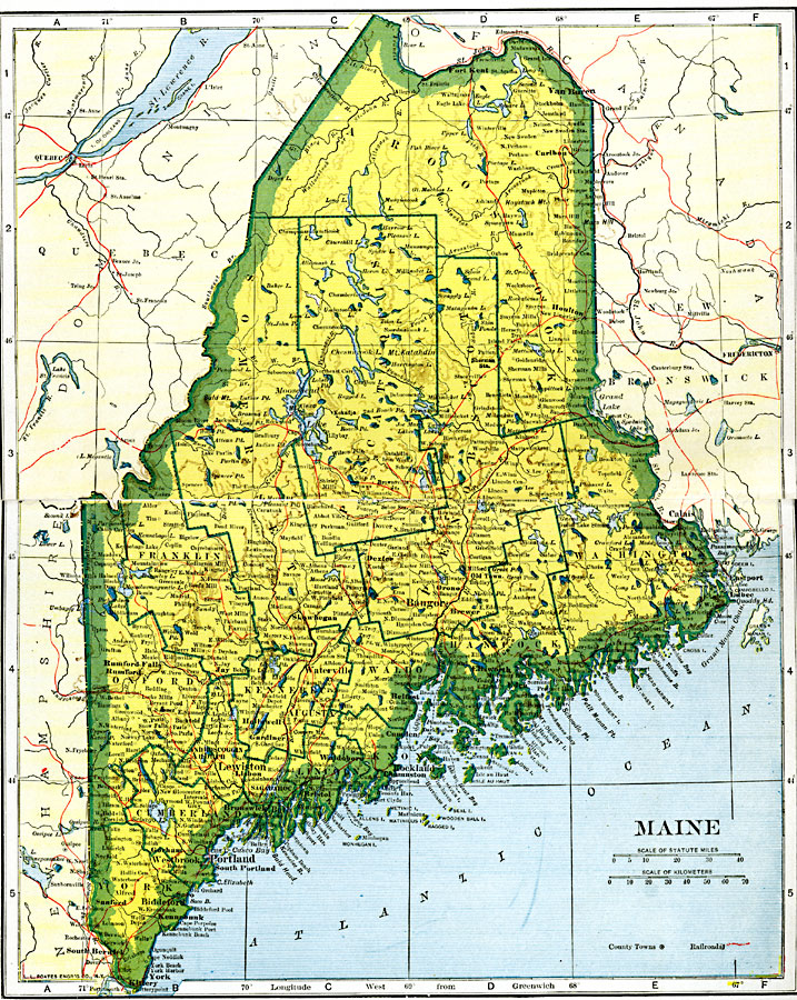
Description: A map from 1920 of Maine showing the State capital of Augusta, counties and county seats, major cities, towns and ports, railroads, mountains, lakes, rivers, and coastal features.
Place Names: Maine, Augusta, �Bangor, �Belfast, �Biddeford, �Bucksport, �Dexter, �Ellsworth, �Lewiston, �Portland, �Princeton, �Whitneyvill
ISO Topic Categories: oceans,
location,
inlandWaters,
transportation
Keywords: Maine, borders, �physical, �railroads, �transportation, �country borders,
county borders, railroads, oceans,
location,
inlandWaters,
transportation, Unknown, 1919
Source: L.L. Poates, Poates Complete Atlas of the World (New York, NY: Poates Corporation , 1921) 62-63
Map Credit: Courtesy the private collection of Roy Winkelman |
|