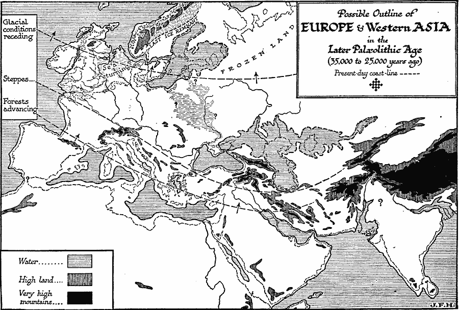
Description: A map showing the possible outline of Europe and West Asia during the Later Paleolithic Age, about 35,000 to 25,000 years ago. . The map shows the present coastal outline in dashed lines, and is keyed to show the supposed areas of water, high lands, and very high mountains during the ice period, and shows the limits of glacial conditions (receding), the steppes, marsh lands, frozen lands, and direction of advancing forests. The Mediterranean basin is shown as two separate bodies of water not attached to the Atlantic, the region of remnant glaciers in Scandinavia, and the returning sea in the North Sea basin.
Place Names: Regional Miscellaneous,
ISO Topic Categories: physical, kWorldMedSea, kWorldAfroAsia, kWorldEurasia
Keywords: Europe in the Later Paleolithic Age, physical, physical features, physical, kWorldMedSea, kWorldAfroAsia, kWorldEurasia, Unknown, 35,000 to 25,000 Y.A.
Source: H. G. Wells, The Outline of History (New York, NY: The Macmillan Company, 1921) 68
Map Credit: Courtesy the private collection of Roy Winkelman |
|