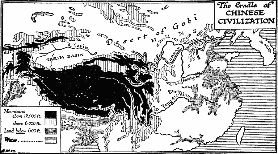
Description: A map of Asia showing the cradle of Chinese civilization around 221 BCE. The map shows the terrain of the region, indicating the mountainous regions above 12,000 feet, highlands above 6,000 feet, and plains below 6,000 feet. The map shows the Tarim Basin in Central Asia, the Great Wall of China built between the 5th century to 221 BC, and major rivers of the region. "Meanwhile, as this triple system of White Man civilization developed in India and in the lands about the meeting–places of Asia, Africa, and Europe, another and quite distinct civilization was spreading out from the then fertile but now dry and desolate valley of the Tarim and from the slopes of the Kuen–lun mountains in two directions down the course of the Hwang–ho, and later into the valley of the Yang–tse–kiang." — Wells, 1921, p. 147.
Place Names: Eastern Asia,
ISO Topic Categories: geoscientificInformation,
location,
oceans,
inlandWaters
Keywords: The Cradle of Chinese Civilization, physical, physical features,
topographical, geoscientificInformation,
location,
oceans,
inlandWaters, Unknown, Ancient China
Source: H. G. Wells, The Outline of History (New York, NY: The Macmillan Company, 1921) 149
Map Credit: Courtesy the private collection of Roy Winkelman |
|