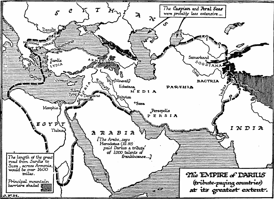
Description: A map of Persia and western Asia showing the greatest extent of the empire of Darius I between 522–486 BC, including tribute–paying countries. The map shows the probable boundaries of the empire, including the lands of Macedonia, Thrace, Egypt, Syria, Lydia, Armenia, Media, Parthia, Samarkand, Bactria, and east to the Indus River. The capital of Persepolis is shown, as well as other important cities of the time, major rivers and principal mountain barriers, and notes that the Persian Royal Road from Sardis in Anatolia, across Armenia, and south to Susa would be over 1600 miles.
Place Names: Southwest Asia, Arabia, �Egypt, �India, �Persi
ISO Topic Categories: inlandWaters,
location,
oceans,
boundaries
Keywords: The Persian Empire of Darius the Great, physical, �political, physical features, major political subdivisions, inlandWaters,
location,
oceans,
boundaries, Unknown, 522–486 BC
Source: H. G. Wells, The Outline of History (New York, NY: The Macmillan Company, 1921) 276
Map Credit: Courtesy the private collection of Roy Winkelman |
|