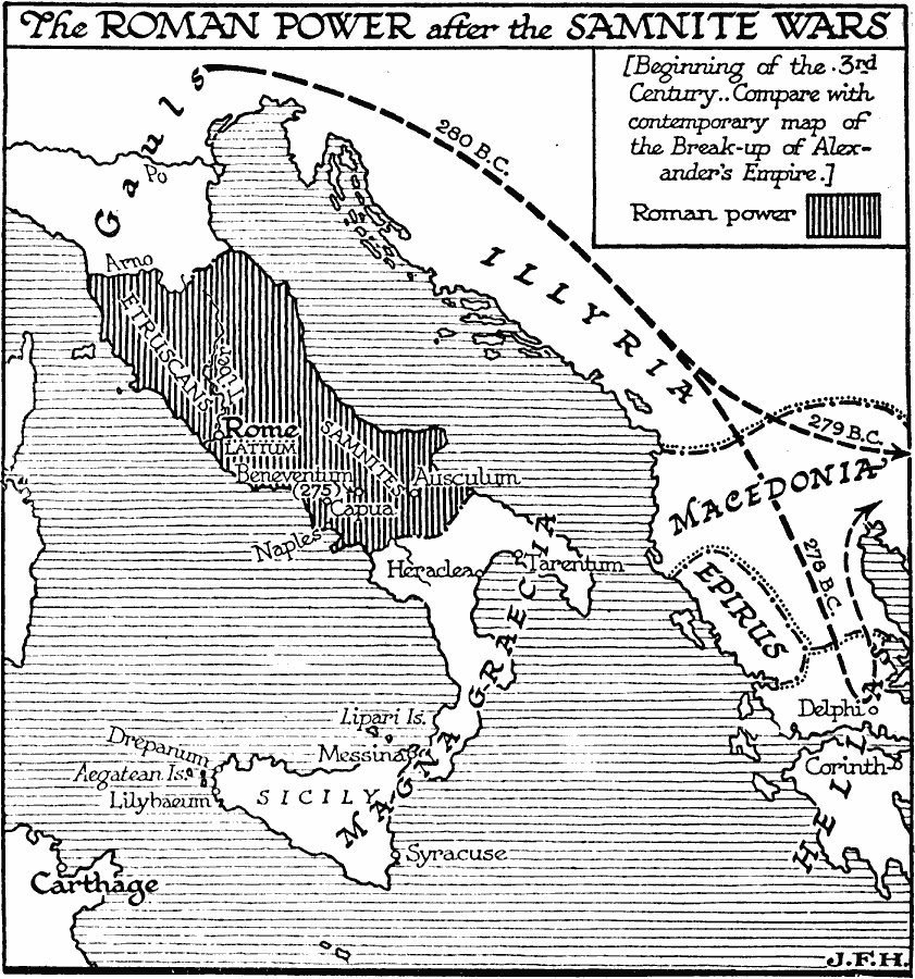
Description: A map of the Roman territories on the Italian Peninsula after the Samnite Wars in 290 BC, showing the cities of Rome, Beneventum, Capua, Naples, and Ausculum, including the territories of Latium, Etruscans, and Samnites under Roman control. The map also shows the Greek territories of Magna Graecia in southern Italy and Sicily, and the territory of the Gauls in northern Italy. This map shows the Gaul migration into Illyria, Macedonia, Epirus, and Hellas between 280 and 278 BC.
Place Names: Italy, Roman Empire, �Carthage, �Illyria, �Macedoni
ISO Topic Categories: boundaries,
inlandWaters,
oceans,
location
Keywords: Roman Power After the Samnite Wars, physical, �political, kRomanEmpire, physical features, major political subdivisions, boundaries,
inlandWaters,
oceans,
location, Unknown, 290 BC
Source: H. G. Wells, The Outline of History (New York, NY: The Macmillan Company, 1921) 386
Map Credit: Courtesy the private collection of Roy Winkelman |
|