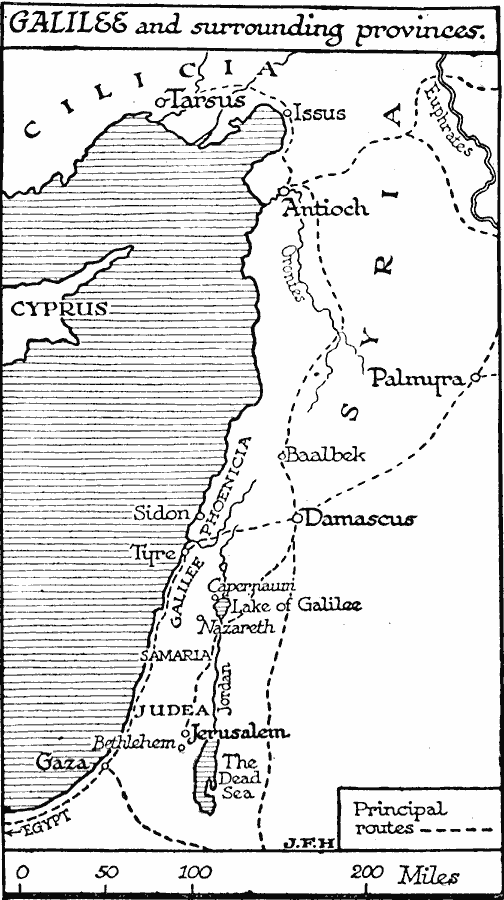
Description: A map of the region around Galilee at the beginning of the Christian era. The map shows the principal travel and trade routes by land through the area from Tarsus in Cilicia to the north to Egypt in the southwest. This map shows the provinces of Galilee, Samaria, Judea, and Phoenicia, the Orontes and Euphrates rivers to the north, the Lake of Galilee, Jordan River, and Dead Sea, and the important trade centers, ports, and places of historical significance of Tarsus, Issus, Antioch, Palmyra, Baalbek, Sidon, Tyre, Damascus, Capernaum, Nazareth, Jerusalem, Bethlehem, and Gaza.
Place Names: Palestine, Israel, �Judea, �Galilee, �Syria, �Cypru
ISO Topic Categories: transportation,
location,
oceans,
inlandWaters
Keywords: Galilee and Surrounding Provinces, physical, �transportation, physical features, roads, transportation,
location,
oceans,
inlandWaters, Unknown, Beginnings of Christianity
Source: H. G. Wells, The Outline of History (New York, NY: The Macmillan Company, 1921) 495
Map Credit: Courtesy the private collection of Roy Winkelman |
|