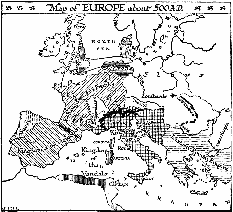
Description: A map of Europe, around AD 500 showing the territories of the Jutes and Saxons and their westward movement to the British Isles, the Anglo Saxons, Scots, Picts, and Britons, Slavs, Lombards, Kingdom of the Franks, Burgundians, Suevi, Kingdom of the Visigoths, Kingdom of the Ostrogoths, the Eastern or Byzantine Roman Empire, and the Kingdom of the Vandals in Northern Africa.
Place Names: Western and Central Europe,
ISO Topic Categories: oceans,
inlandWaters,
location
Keywords: Europe, physical, �political, �statistical, physical features, major political subdivisions, ethnological, oceans,
inlandWaters,
location, Unknown, A.D. 500
Source: H. G. Wells, The Outline of History (New York, NY: The Macmillan Company, 1921) 529
Map Credit: Courtesy the private collection of Roy Winkelman |
|