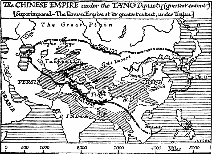
Description: A map of Asia showing the greatest extent of the imperial Chinese Tang Dynasty (AD 618 to 907). At this time, the empire stretched from the Caspian Sea in the west to the Lu–Chu Islands (Ryukyu Islands) in the east, and from the Altai Mountains in the north to the Himalayas in the south. A shaded outline map of the Roman Empire at its greatest extent, under Trajan, is superimposed on the map of the Tang Dynasty to show comparative area size of the empires.
Place Names: Miscellaneous Asia, India, �China, �Japan, �Persia, �Tibet, �Arabi
ISO Topic Categories: boundaries,
location,
oceans,
inlandWaters
Keywords: The Tang Empire, physical, �political, kComparativeArea, physical features, major political subdivisions, boundaries,
location,
oceans,
inlandWaters, Unknown, AD 618 to 907
Source: H. G. Wells, The Outline of History (New York, NY: The Macmillan Company, 1921) 552
Map Credit: Courtesy the private collection of Roy Winkelman |
|