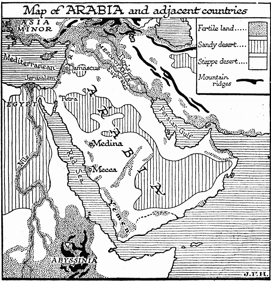
Description: A map of Arabia and adjacent countries around 700 BC to "Illustrate the historic era at the beginning of records.". This map shows regions of fertile lands, sandy deserts, steppe deserts, and mountain ridges. The Tigris, Euphrates, and Nile rivers are shown, as well as the major cities Damascus, Jerusalem, Petra, Medina, and Mecca, and the areas of Asia Minor, Mesopotamia, Egypt, Abyssinia, and Yemen. "From time immemorial Arabia, except for the fertile strip of the Yemen to the south, has been the land of nomads, the headquarters and land of origin of the Semitic peoples. From Arabia at various times waves of these nomads had drifted north, east, and west into the early civilizations of Egypt, the Mediterranean coast, and Mesopotamia." — Wells, 1921, p. 3.
Place Names: Arabia, Africa, �Asia, �Arabia, �Medina, �Mecc
ISO Topic Categories: oceans,
location,
inlandWaters
Keywords: Arabia, physical, �statistical, physical features, vegetation, oceans,
location,
inlandWaters, Unknown, 700 BC
Source: H. G. Wells, The Outline of History (New York, NY: The Macmillan Company, 1921) 569
Map Credit: Courtesy the private collection of Roy Winkelman |
|