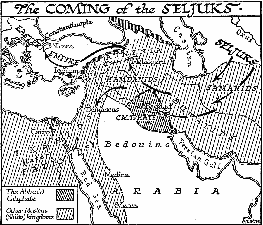
Description: A map of Asia Minor and northern Arabia during the revival of Islam under the Seljuk Turks from around AD 1000. The map shows the territories of the Abbasid Caliphate (Bagdad) and other Moslem (Shiite) kingdoms, the territories of the Samanids, Buwayids, Hamanids, Bedouins, and Ikshids, and the cities of Constantinople, Nicaea, Iconium, Melasgerd, Bagdad, Damascus, Cairo, Medina, and Mecca, The map shows the area of the Caspian steppes near the River Oxus where the Seljuks originated, their movement into Persia and the Abbasid Caliphate, the city of Melasgerd (Malazgirt) where Seljuk forces crushed the Byzantine army in 1071, and their movement into Aetolia and Syrian Damascus.
Place Names: Regional AfroAsia, Africa, �Asia, �Europ
ISO Topic Categories: physical, �political, kWorldAfroAsia
Keywords: Coming of the Seljuks, physical, �political, physical features, major political subdivisions, physical, �political, kWorldAfroAsia, Unknown, 1000
Source: H. G. Wells, The Outline of History (New York, NY: The Macmillan Company, 1921) 634
Map Credit: Courtesy the private collection of Roy Winkelman |
|