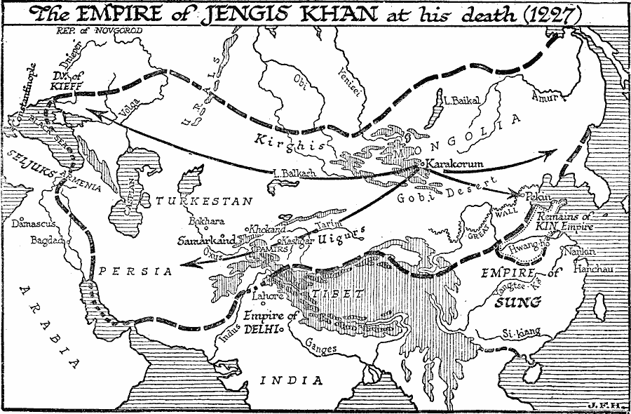
Description: A map of the empire of Genghis Khan at the time of his death (1227) extending from the Pacific Ocean to the Dnieper River on the Black Sea and into Persia. The map shows the Mongolian expansion from Karakorum eastward to the Amur River region and across the Great Wall to Peking (Beijing) and the borders of the remains of the Kin Empire, and westward to the Russian Dynasty of Kieff and south into Persia. The map shows important cities of the time, including Constantinople, Damascus, Bagdad, Samarkand, Delhi, Hanchau, Nankin, Peking, and Kashgar, major rivers, the territories of the Kirghis, Uigurs, Seljuks, Empire of Delhi, and Empire of Sung, and mountain systems of the region.
Place Names: Miscellaneous Asia, India, �Persia, �Turkestan, �Mongoli
ISO Topic Categories: boundaries,
location,
oceans,
inlandWaters
Keywords: Empire of Genghis Khan at the Time of his Death, physical, �political, physical features, major political subdivisions, boundaries,
location,
oceans,
inlandWaters, Unknown, 1227
Source: H. G. Wells, The Outline of History (New York, NY: The Macmillan Company, 1921) 671
Map Credit: Courtesy the private collection of Roy Winkelman |
|