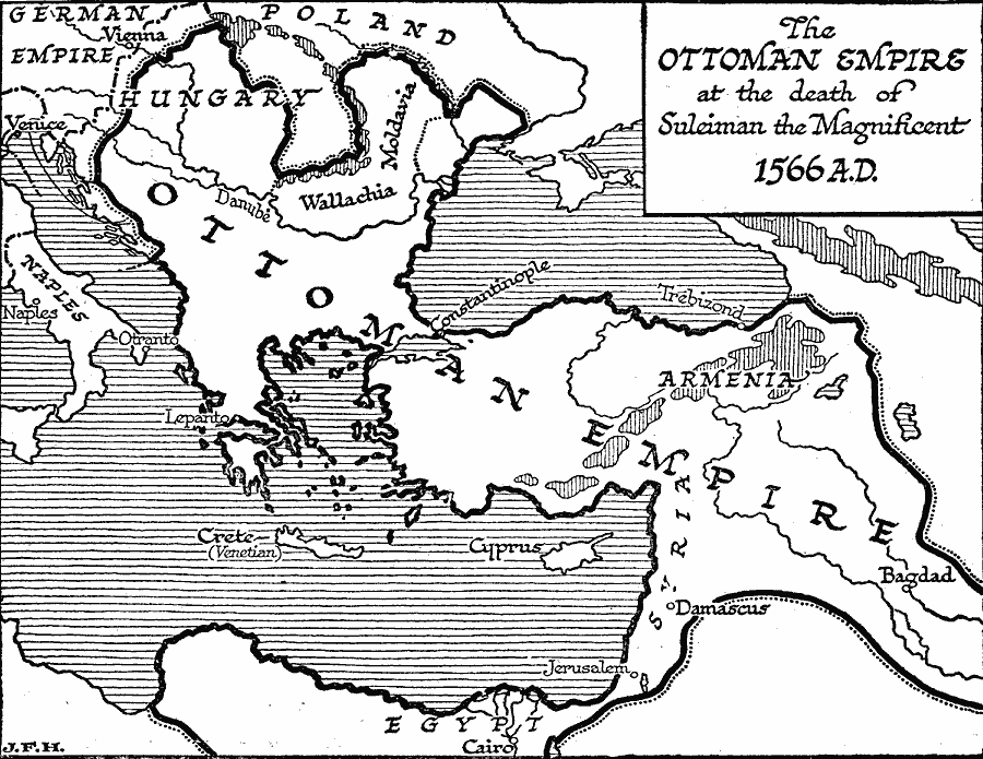
Description: A map showing the extent of the Ottoman Empire at the death of Suleiman the Magnificent in 1566. The Ottoman Turks had by this time conquered the Byzantine capital Constantinople (1453), and spread across Anatolia, Armenia, Syria and Mesopotamia, Egypt, Greece, Hungary, Wallachia, and Moldavia. The Ottomans controlled the important seagoing and overland trade centers of the Black Sea (Constantinople and Trebizond) and the river Danube (into Europe) and Dnieper (into Russia), the western Silk Road seaports (Smyrna and Antioch), Red Sea trade (Cairo and Jerusalem), and the Persian Gulf (Bagdad).
Place Names: Regional Mediterranean, Europe, �Asi
ISO Topic Categories: physical, �political, kWorldMedSea, kWorldEurasia, kWorldAfroAsia
Keywords: Ottoman Empire at the Death of Suleiman the Magnificent, physical, �political, physical features, major political subdivisions, physical, �political, kWorldMedSea, kWorldEurasia, kWorldAfroAsia, Unknown, 1566
Source: H. G. Wells, The Outline of History (New York, NY: The Macmillan Company, 1921) 686
Map Credit: Courtesy the private collection of Roy Winkelman |
|