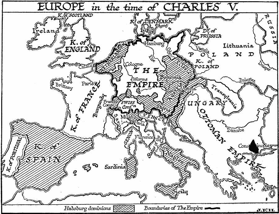
Description: A map of Europe in 1519 at the time of Charles V, Holy Roman Emperor. This map shows the dominions of the Habsburgs, which included ":The Empire" consisting of the Netherlands, Silesia, Bohemia, Austria, Styria, Swiss Confederation, Franche Comte, and the German States. The Habsburg dominions also included the Kingdom of Spain, Milan, Sardinia, Sicily, and Naples. The map also shows the kingdoms of Portugal, France, England, Scotland, Denmark, and Poland, and the Duchy of Prussia, Transylvania, Savoy, Venice, Genoa, and the States of the Church. The map also shows the extent of the Ottoman Empire in Europe at the time.
Place Names: Western and Central Europe, Spain, �France, �England, �Ireland, �Holy Roman Empire, �Poland, �Ottoman Empir
ISO Topic Categories: boundaries,
location,
oceans,
inlandWaters
Keywords: Europe in the Time of Charles V, physical, �political, physical features, country borders, boundaries,
location,
oceans,
inlandWaters, Unknown, 1519–1556
Source: H. G. Wells, The Outline of History (New York, NY: The Macmillan Company, 1921) 756
Map Credit: Courtesy the private collection of Roy Winkelman |
|