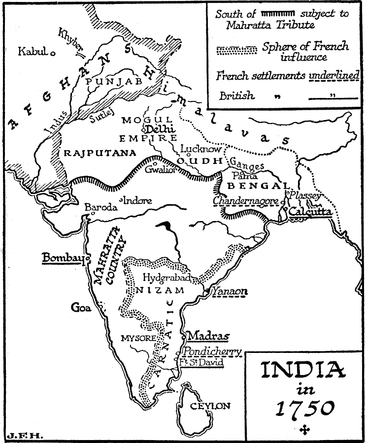
Description: A map of the Indian subcontinent around 1750, prior to the beginnings of British control under the East India Company. The map shows the region south of the Ganges that was subject to Mahratta (Maratha Empire) tribute, the Mogul Empire to the north of the Ganges, the French spheres of influence in Carnatic and Nizam (Hyderabad), and the French and British settlements at the time. The map shows the location of Plassey, where the British East India Company, under Robert Clive, won a significant battle against the Nawab of Bengal, leading to the eventual formation of British India.
Place Names: India , Madras, �Goa, �Mumbai,�Bombay, �Calcutta, �Kolkata, �Delh
ISO Topic Categories: transportation,
boundaries,
oceans,
location,
inlandWaters
Keywords: India at the beginning of British East India Control, physical, �political, physical features, country borders, transportation,
boundaries,
oceans,
location,
inlandWaters, Unknown, 1750
Source: H. G. Wells, The Outline of History (New York, NY: The Macmillan Company, 1921) 810
Map Credit: Courtesy the private collection of Roy Winkelman |
|