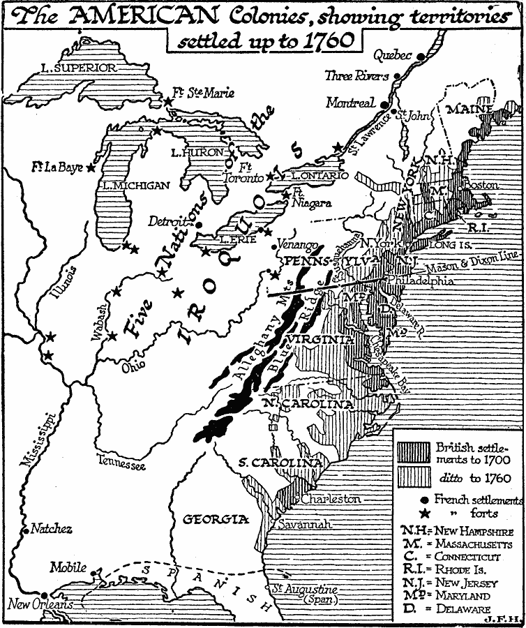
Description: A map of eastern North America showing the expansion of the British colonies in the region from 1700 to 1760. The map shows the Thirteen Colonies, the boundary of Spanish claims in Florida, the territory of the Five Nations of the Iroquois, the Great Lakes, St. Lawrence River, Alleghany Mountains and Blue Ridge. The map is hachure–coded to show the territory of British settlements up to 1700, and the expansion up to 1760. The map also shows French settlements and forts, and indicates the Mason–Dixon Line surveyed in 1763–1767.
Place Names: A Regional Map of North America, United States, �Canad
ISO Topic Categories: oceans,
location,
inlandWaters
Keywords: The British Colonies in North America, political, �physical, physical features, major political subdivisions, oceans,
location,
inlandWaters, Unknown, 1700–1760
Source: H. G. Wells, The Outline of History (New York, NY: The Macmillan Company, 1921) 830
Map Credit: Courtesy the private collection of Roy Winkelman |
|