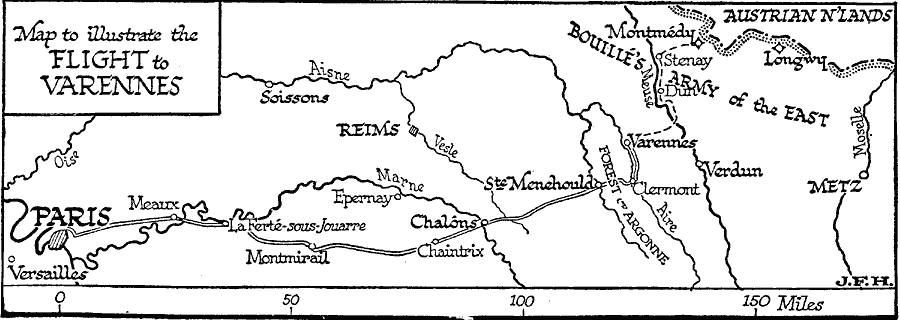
Description: A map to illustrate Louis XIV's flight from Paris to Varennes during the French Revolution (June 21, 1791). The goal of his unsuccessful escape was Montmédy, a Royalist citadel in northeastern France under control of Bouillé's Army of the East. The royal family was recognized in Ste. Menehould, captured in Varennes, returned to Paris, and Louis XIV was executed on January 21, 1793.
Place Names: France, Paris, �Versailles, �Meaux, �Chalones, �Clermont, �Met
ISO Topic Categories: boundaries,
inlandWaters,
intelligenceMilitary,
location
Keywords: Flight to Varennes, physical, �political, �transportation, kFrenchRevolution, physical features, country borders, roads, boundaries,
inlandWaters,
intelligenceMilitary,
location, Unknown, 1791
Source: H. G. Wells, The Outline of History (New York, NY: The Macmillan Company, 1921) 867
Map Credit: Courtesy the private collection of Roy Winkelman |
|