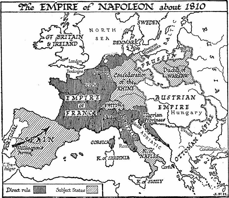
Description: A map of Europe showing the empire of Napoleon, during the Napoleonic Wars around 1810, including lands under direct control (Empire of France, Kingdom of Italy, Illyrian Provinces, Corsica, Corfu, and the Netherlands) and the subject states of Spain, Kingdom of Sicily, Confederation of the Rhine, and the Duchy of Warsaw. This map also shows Portugal, Great Britain and Ireland, Denmark, Swedish Pomerania, Prussia, the Austrian Empire, and the Ottoman Empire in Europe. The route of Wellington's Army during the Peninsular War in Spain is shown.
Place Names: Western and Central Europe, France, �Spain, �Austria, �Spain, �Portugal, �Great Britain, �Sweden, �Prussia, �Ottoman Empir
ISO Topic Categories: inlandWaters,
intelligenceMilitary,
oceans,
location,
boundaries
Keywords: The Empire of Napoleon, physical, �political, kEuropeanOttomanEmpire, kNapoleonicWars, physical features, country borders, inlandWaters,
intelligenceMilitary,
oceans,
location,
boundaries, Unknown, 1810
Source: H. G. Wells, The Outline of History (New York, NY: The Macmillan Company, 1921) 908
Map Credit: Courtesy the private collection of Roy Winkelman |
|