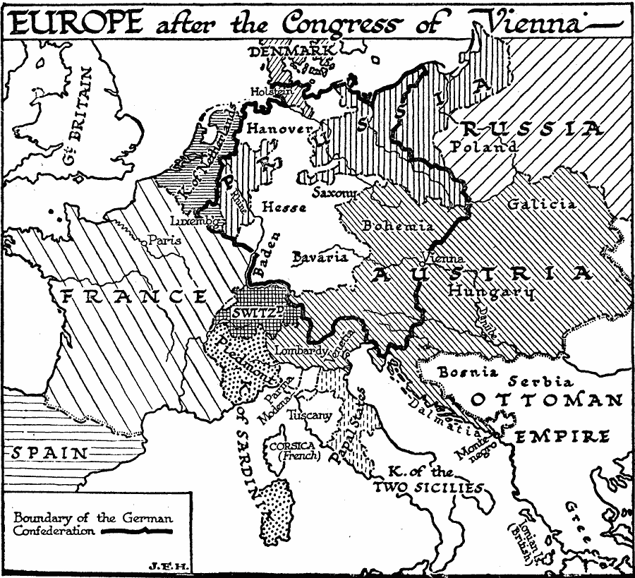
Description: A map of Europe after the Congress of Vienna in 1815, which redrew the continent's political boundaries after the French Revolution, Napoleonic Wars, and the dissolution of the Holy Roman Empire. This map shows the established boundary of the German Confederation, including Holstein, Hanover, Luxemburg, Hesse, Saxony, Baden, Bavaria, Bohemia, and the western portions of Prussia and Austria. Non–Confederation countries shown include the Kingdom of Netherlands, France, Switzerland, Piedmont, Kingdom of Sardinia, Corsica (under French control) Lombardy, Parma, Modena, Tuscany, Papal States, Kingdom of the Two Sicilies, Hungary, Galicia, Poland, portions of Russia and the Ottoman Empire, and the eastern portion of Prussia.
Place Names: Western and Central Europe, France, �Austria, �Russia, �Denmark, �German Confederation, Holstein, Hanover, Luxemburg, Hesse, Saxony, Baden, Bavaria, Bohemia, Prussia, Kingdom of Netherlands, Switzerland, Piedmont, Kingdom of Sardinia, Corsica, Lombardy, Parma, Modena, Tuscany, Papal States, Kingdom of the Two Sicilies, Hungary, Galicia, Poland, Ottoman Empire
ISO Topic Categories: boundaries,
location,
inlandWaters,
oceans
Keywords: Europe After the Congress of Vienna, physical, �political, physical features, country borders, boundaries,
location,
inlandWaters,
oceans, Unknown, 1815
Source: H. G. Wells, The Outline of History (New York, NY: The Macmillan Company, 1921) 918
Map Credit: Courtesy the private collection of Roy Winkelman |
|