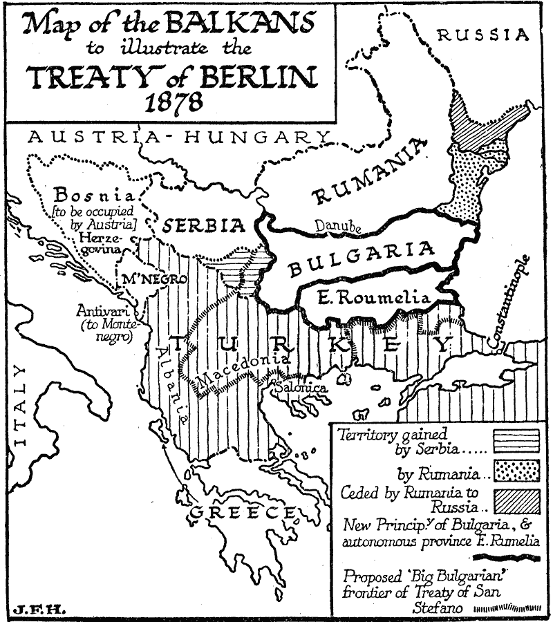
Description: A map of the Balkans to illustrate the territorial changes under the Treaty of Berlin, 1878, showing the territory gained by Serbia and Rumania, the territory ceded by Rumania to Russia, the new Principality of Bulgaria and the autonomous province of Eastern Rumelia, and the "Big Bulgarian" frontier proposed in the Treaty of San Stefano in 1878. The map also shows Bosnia–Herzegovina being occupied by Austria, and Antivari to Montenegro.
Place Names: Southeastern Europe, Serbia, �Bulgaria, �Romania, �Turkey, �Greece, �Bosnia, �Montenegro, �Russi
ISO Topic Categories: boundaries,
location,
oceans,
inlandWaters
Keywords: The Balkans, physical, �political, physical features, country borders, boundaries,
location,
oceans,
inlandWaters, Unknown, 1878
Source: H. G. Wells, The Outline of History (New York, NY: The Macmillan Company, 1921)
Map Credit: Courtesy the private collection of Roy Winkelman |
|