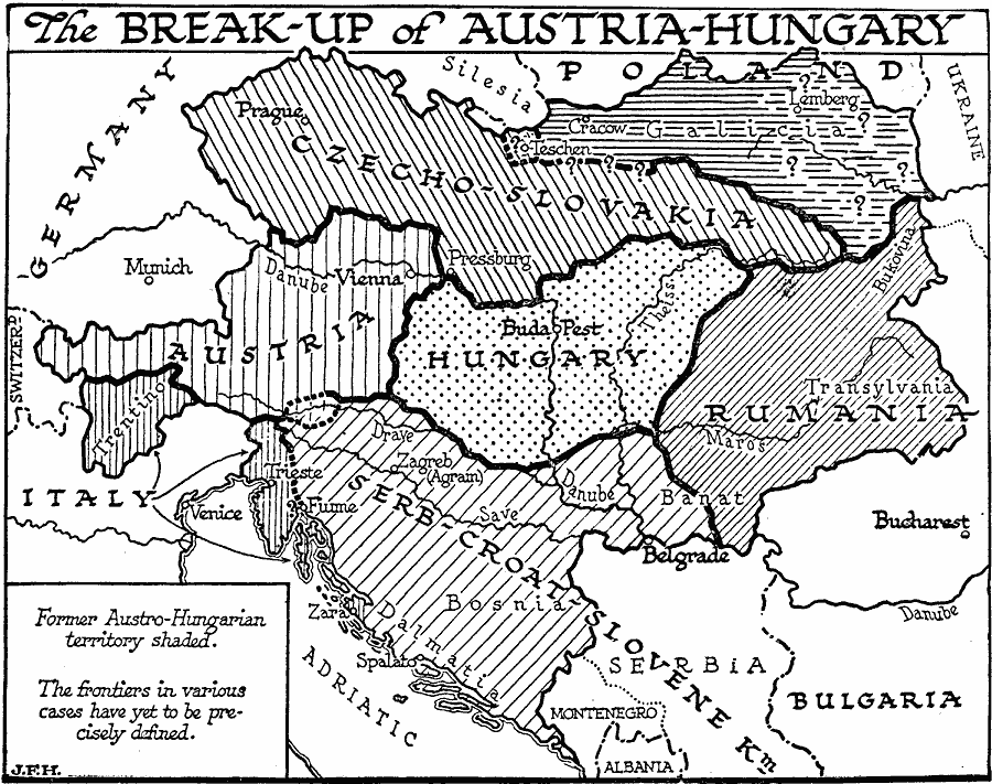
Description: A map showing the breakup of Austria–Hungary under the Treaty of Saint Germain (Austria) and the Treaty of Trianon (Hungary) at the close of the First World War. This map shows the newly established boundaries for the former territories of Galicia, Czecho–Slovakia, Austria, Hungary, Rumania, Trentino (to Italy), and portions of the Serb–Croat–Slovene Kingdom, part of which went to Italy (Trieste and Dalmatian Coast to Zara) and part to become Bosnia. As noted on the map, not all borders, frontiers, or territories were clearly established (Galicia–Czech) at the time.
Place Names: Austria-Hungary, Italy, �Austria, �Germany, �Czechoslovakia, �Hungary, �Romani
ISO Topic Categories: boundaries,
location,
oceans,
inlandWaters
Keywords: The Breakup of Austria-Hungary, physical, �political, physical features, country borders, boundaries,
location,
oceans,
inlandWaters, Unknown, 1918
Source: H. G. Wells, The Outline of History (New York, NY: The Macmillan Company, 1921) 1079
Map Credit: Courtesy the private collection of Roy Winkelman |
|