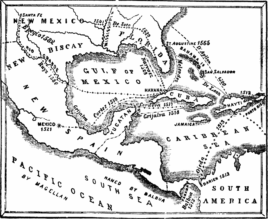
Description: A map of the Gulf of Mexico and Caribbean showing the voyage routes of the early European explorers in the region between 1512 and 1580. The map shows the routes of Alonzo de Ojeda to Darién Colombia, Balboa to the Pacific, Juan Ponce de Leon to Florida, Francisco de Cordova to the Yucatan, Juan de Grijalva to the southern coast of Mexico, Hernán Cortez to Mexico City, Lucas Vasquez d'Ayllon to the Carolinas, Pánfilo de Narváez to Florida, Hernando de Soto to Florida and overland to the Mississippi, Melendez (Pedro Menéndez de Avilés) to St. Augustine, Friar Augustine Ruyz and Don Antonio de Espego along the Rio Grande.
Place Names: A Regional Map of North America, Cuba, �Mexico, �United State
ISO Topic Categories: oceans,
location,
inlandWaters,
boundaries
Keywords: Early Voyages of the Spaniards in the West Indies, borders, �physical, �historical, �transportation, �water routes, country borders, water routes, historical event, oceans,
location,
inlandWaters,
boundaries, Unknown, 1512–1580
Source: David B. Scott, A School History of the United States, from the discovery of America to the year 1880. (New York, NY: American Book Company, 1884) 28
Map Credit: Courtesy the private collection of Roy Winkelman |
|