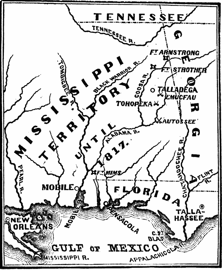
Description: A map of the Mississippi Territory at the time of the Creek War between the Creek Nation (Muscogee) and the Cherokees, Choctaws, and eventually the United States (1813–1814). The map shows the U.S. forts in the area (Armstrong, Strother, and Mims), the cities of New Orleans, Pensacola, Tallahassee, and Talladega, rivers, and the battle sites of Fort Mims, Tohopeka, Autossee, and Emucfau.
Place Names: Growth of Nation, Florida, �Ft. Armstrong, �Ft. Strother, �Georgia, �Louisiana, �Mississippi, �Mobile, �Talladega, �Tallahassee, �Tennessee, �War of 1812, �Creek Wa
ISO Topic Categories: oceans,
location,
inlandWaters
Keywords: Seat of the Creek War, physical, �historical, �military, �war, kNativeAmerican, country borders, historical event, oceans,
location,
inlandWaters, Unknown, 1813
Source: David B. Scott, A School History of the United States, from the discovery of America to the year 1880. (New York, NY: American Book Company, 1884) 259
Map Credit: Courtesy the private collection of Roy Winkelman |
|